Site Classification
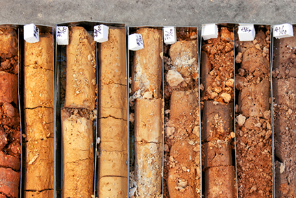
All geotechnical projects utilise GIS technology, which integrates fields of data to deliver a better understanding of the project as a whole. Everything, from identifying geological risks and hazards, through planning and tracking field work, to generating detail project maps, is supported by this technology. Once we are through with the field assessment from the client , we gather the test results and prepare a detailed report outlining the existing site conditions and properties. This further helps us analyse the risk and identify the site classification and soil classification.we do Site classifications in accordance with AS2870